Beauty For All
Bonaire is one of the most beautiful islands in the Dutch Caribbean, so sightseeing is a must. Sign up for a sunset cruise, or visit top spots on the island like the Washington Slagbaai National Park, the Mangazina di Rei Museum, Bara di Karta or the famed Donkey Sanctuary.
Hire a local guide to learn even more about Bonaire’s history, culture, flora & fauna, and don’t forget your camera, because the beauty of Bonaire is one of the island’s finest attractions!
Sightseeing
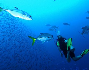
Bonaire has several museums and cultural attractions, but many visit this tiny Dutch island for its world-class diving and snorkeling. Bonaire’s barrier reef is well-protected and considered one of the most vibrant and healthy habitats of its kind in the world. It’s the peak of a submerged volcanic mountain, with sloping reefs just 30 feet from the shore, so you don’t need to join a charter boat to get great diving. Underwater visibility is 100 feet year-round, and there are 86 marked dive sites. Back on land, visitors can enjoy even more activities with an active edge, from mountain biking to land sailing.
Aletta's Goat Farm
-
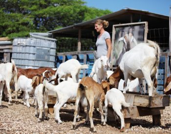
Aletta’s Semper Kontentu Goat Cheese, Goat Yoghurt and Goat Milk are traditionally handmade on the island of Bonaire. Her products are available at main local supermarkets. Also look for “Aletta’s Semper Kontentu Goat Cheese”on your restaurant menu. Book a tour to meet the goats and see the milking & cheese making. Refreshing ice tea & cheese tasting are included. You can visit Aletta and her Goats on Mondays, Wednesdays and Fridays. The tour starts at 9.00am. The price for an Adult is US$ 15 and for children 12 years or younger US$ 7. Call for Reservation: +599 786 6950.
- Office Hours: Monday, Wednesday & Friday
- Tour Starts: 9:00 a.m.
- Price: US $15/Kids Under 12 US $7
- For Reservations: +599 786 6950
Aletta’s Semper Kontentu Goat Cheese, Goat Yoghurt and Goat Milk are traditionally handmade on the island of Bonaire. Her products are available at main local supermarkets. Also look for “Aletta’s Semper Kontentu Goat Cheese”on your restaurant menu. Book a tour to meet the goats and see the milking & cheese making. Refreshing ice tea & cheese tasting are included. You can visit Aletta and her Goats on Mondays, Wednesdays and Fridays. The tour starts at 9.00am. The price for an Adult is US$ 15 and for children 12 years or younger US$ 7. Call for Reservation: +599 786 6950.
Bara Di Karta
From the Bara di Karta water well starts the hiking route in the west direction. The first approximately 150 meters is composed of a slightly inclined ground. Be carefull since the surface is relatively loose and good shoes are required. After the first 150 meters, the climb to the top begins. The top will be reached in about 10 minutes; from which a large part of the island can be observed. Kralendijk and Klein Bonaire can be seen to the west. On the east side you can see the airport, the salt pans, Lac mangroves, the rough east coast and in the distance the lighthouse Cave. Traditional kunuku landscape can be seen, with small-scale farms, the “kunuku” roads, dyke and windmills. The Bara di Karta consist of a biking, hiking and driving route.
From the Bara di Karta water well starts the hiking route in the west direction. The first approximately 150 meters is composed of a slightly inclined ground. Be carefull since the surface is relatively loose and good shoes are required. After the first 150 meters, the climb to the top begins. The top will be reached in about 10 minutes; from which a large part of the island can be observed. Kralendijk and Klein Bonaire can be seen to the west. On the east side you can see the airport, the salt pans, Lac mangroves, the rough east coast and in the distance the lighthouse Cave. Traditional kunuku landscape can be seen, with small-scale farms, the “kunuku” roads, dyke and windmills. The Bara di Karta consist of a biking, hiking and driving route.
Botanical Garden
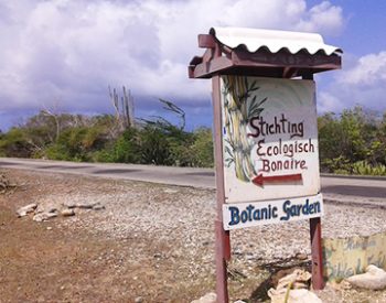
- Office Hours: Wednesday – Saturday
- Tours: 10:00 a.m. – 6:00p.m.
- Price: Adults US $10/Kids US $5
Brandaris
The Brandaris is the highest peak on Bonaire, 241m (784 ft.) high, situated in the Washington Slagbaai National Park. The Subí Brandaris Trail is a 45-minute hike to the Brandaris. This is a medium-difficulty climb, and the view from the top is a really fantastic reward for making the trip. On a clear day you can see the island of Curaçao and, on exceptionally clear days, the Santa Ana Hill in the Paraguaná Peninsula of Venezuela, and the mountain range south of Puerto Cabello, Venezuela. Unlike the other trails, the Subí Brandaris trail does not start at the Visitor Center of the park; you need a vehicle to enter the park and take you to the base of the hill. Hikers to the Brandaris are required to be at the park before noon.
The Brandaris is the highest peak on Bonaire, 241m (784 ft.) high, situated in the Washington Slagbaai National Park. The Subí Brandaris Trail is a 45-minute hike to the Brandaris. This is a medium-difficulty climb, and the view from the top is a really fantastic reward for making the trip. On a clear day you can see the island of Curaçao and, on exceptionally clear days, the Santa Ana Hill in the Paraguaná Peninsula of Venezuela, and the mountain range south of Puerto Cabello, Venezuela. Unlike the other trails, the Subí Brandaris trail does not start at the Visitor Center of the park; you need a vehicle to enter the park and take you to the base of the hill. Hikers to the Brandaris are required to be at the park before noon.
Caves
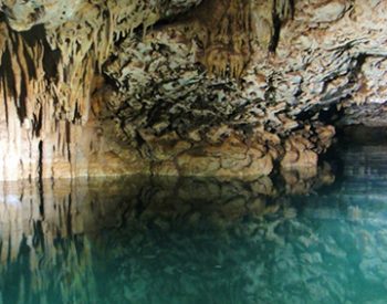
There are many cave formations found on Bonaire. Several are readily accessible while others lie hidden and filled with water. They are a crucial part of the islands ecosystem. The caves that are filled with water are part of an extensive aquifer that is used to help the farmers grow crops and the shallower formations serve as a water source for feral goats and donkeys. The other mammals that benefit are the numerous bats that spend their days hanging upside down in the caves until sunset. Then they swarm out for a night of eating, consuming mosquitoes and other insects! Other bats are working to sip the nectar from night blooming cactus and doing the same job that bees accomplish during the day. By spreading pollen the bats play an important role in keeping the ecosystem operating!
There are many cave formations found on Bonaire. Several are readily accessible while others lie hidden and filled with water. They are a crucial part of the islands ecosystem. The caves that are filled with water are part of an extensive aquifer that is used to help the farmers grow crops and the shallower formations serve as a water source for feral goats and donkeys. The other mammals that benefit are the numerous bats that spend their days hanging upside down in the caves until sunset. Then they swarm out for a night of eating, consuming mosquitoes and other insects! Other bats are working to sip the nectar from night blooming cactus and doing the same job that bees accomplish during the day. By spreading pollen the bats play an important role in keeping the ecosystem operating!
Donkey Sanctuary
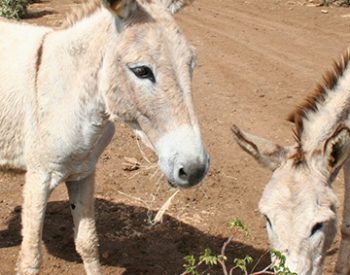
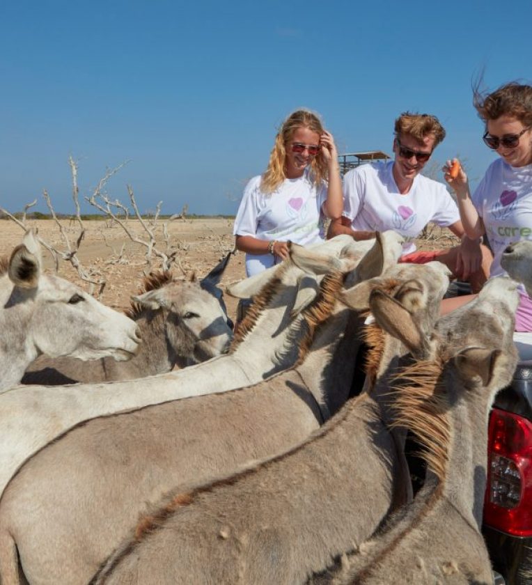
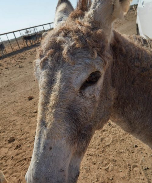
In 1993 Dutch Nationals, Marina Melis and her husband Ed Koopman, established a donkey sanctuary on Bonaire for sick, wounded and orphaned donkeys: Donkey Sanctuary Bonaire. The primary objective of Donkey Sanctuary Bonaire is to offer a sheltered, protected life to all the donkeys of Bonaire. Our information about the lives and experiences of donkeys is also raising awareness amongst the local community, schools and tourists. At this moment there are more than 400 donkeys living in Donkey Sanctuary Bonaire. They are provided with food, drinking water and medical care and have plenty of room and freedom. Still the work of Donkey Sanctuary Bonaire is badly needed.
In 1993 Dutch Nationals, Marina Melis and her husband Ed Koopman, established a donkey sanctuary on Bonaire for sick, wounded and orphaned donkeys: Donkey Sanctuary Bonaire. The primary objective of Donkey Sanctuary Bonaire is to offer a sheltered, protected life to all the donkeys of Bonaire. Our information about the lives and experiences of donkeys is also raising awareness amongst the local community, schools and tourists. At this moment there are more than 400 donkeys living in Donkey Sanctuary Bonaire. They are provided with food, drinking water and medical care and have plenty of room and freedom. Still the work of Donkey Sanctuary Bonaire is badly needed.
Downtown Kralendijk
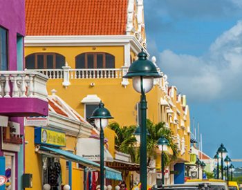
Kralendijk is the capital city and main port of the island of Bonaire. In Dutch, Koralendijk (of which the name Kralendijk is a degeneration) means “coral reef” or “coral dike”. In Papiamentu, the town is often called Playa or “beach”. Kralendijk is a lively and colorful Caribbean town centre. Year round you can stroll the streets enjoying the Caribbean architecture while shopping in the main street Kaya Grandi and the area around it. From November till April there are cruise ships docking at the North or South Pier. On those days there is a market on the Wilhelmina square with island-made products.
Kralendijk is the capital city and main port of the island of Bonaire. In Dutch, Koralendijk (of which the name Kralendijk is a degeneration) means “coral reef” or “coral dike”. In Papiamentu, the town is often called Playa or “beach”. Kralendijk is a lively and colorful Caribbean town centre. Year round you can stroll the streets enjoying the Caribbean architecture while shopping in the main street Kaya Grandi and the area around it. From November till April there are cruise ships docking at the North or South Pier. On those days there is a market on the Wilhelmina square with island-made products.
Echo's Conservation
- Office Hours: Wednesday
- Tours Start: 4:30p.m.
- Price: Free!
Gotomeer
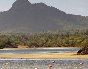
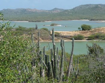
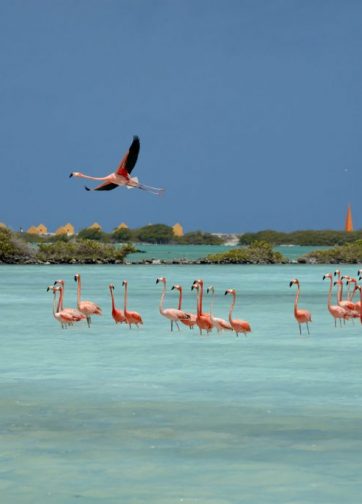
Gotomeer is a saltwater lagoon near the island’s northern end and it is a flamingo hangout. Bonaire is one of the few places in the world where pink flamingos nest. The shy, spindly-leg creatures, affectionately called “pink clouds”, are magnificent birds to observe. The best time to catch them at home is January to June, when they tend to their gray-plumed young. For the best view take the paved access road alongside the lagoon through the jungle of cacti to the parking and observation area on the rise overlooking the lagoon and Washington Slagbaai National Park beyond.
Gotomeer is a saltwater lagoon near the island’s northern end and it is a flamingo hangout. Bonaire is one of the few places in the world where pink flamingos nest. The shy, spindly-leg creatures, affectionately called “pink clouds”, are magnificent birds to observe. The best time to catch them at home is January to June, when they tend to their gray-plumed young. For the best view take the paved access road alongside the lagoon through the jungle of cacti to the parking and observation area on the rise overlooking the lagoon and Washington Slagbaai National Park beyond.
Klein Bonaire
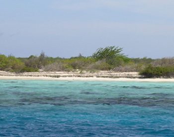
Klein Bonaire is a small uninhabited island located just off the coast of Bonaire. It is about half a mile from Bonaire at its closest point. The island encompasses over 1500 acres. The development of Klein Bonaire was attempted a few times in the past. The final try in 1995, was also unsuccessful. Concerned locals rallied to save Klein Bonaire from development. The Foundation for the Preservation of Klein Bonaire (FPKB) was born. Through efforts of the FPKB and other concerned parties, and monies from the Department of the Interior and Kingdom Affairs of the Netherlands, the World Nature Fundation of the Netherlands and FPKB, the government purchased the island. Klein Bonaire is included in the protection of the Bonaire National Marine Park and is home to turtle nesting grounds.
Klein Bonaire is a small uninhabited island located just off the coast of Bonaire. It is about half a mile from Bonaire at its closest point. The island encompasses over 1500 acres. The development of Klein Bonaire was attempted a few times in the past. The final try in 1995, was also unsuccessful. Concerned locals rallied to save Klein Bonaire from development. The Foundation for the Preservation of Klein Bonaire (FPKB) was born. Through efforts of the FPKB and other concerned parties, and monies from the Department of the Interior and Kingdom Affairs of the Netherlands, the World Nature Fundation of the Netherlands and FPKB, the government purchased the island. Klein Bonaire is included in the protection of the Bonaire National Marine Park and is home to turtle nesting grounds.
Lac
Lac, part of the Bonaire National Marine Park, is the biggest lagoon of the ABC Islands, 700 hectares. Since 1980 Lac has been a RAMSAR site, recognized globally as a wetlands of special significance. The ecosystem of Lac is very fragile. To ensure a proper balance zones have been instituted. Lac is home to three globally endangered species: the Green Turtle, the Queen Conch and the mangrove trees. From north to south, Lac is 3.9 km (not quite 2.5 miles) long, and from east to west 3 km (just under 2 miles). The water surface is approximately 8 square kilometers (3.09 square miles). Lac is bordered by a barrier reef across most of its entrance to the open sea, and lush mangroves just about everywhere else. It has two peninsulas: Cai and Sorobon.
Lac, part of the Bonaire National Marine Park, is the biggest lagoon of the ABC Islands, 700 hectares. Since 1980 Lac has been a RAMSAR site, recognized globally as a wetlands of special significance. The ecosystem of Lac is very fragile. To ensure a proper balance zones have been instituted. Lac is home to three globally endangered species: the Green Turtle, the Queen Conch and the mangrove trees. From north to south, Lac is 3.9 km (not quite 2.5 miles) long, and from east to west 3 km (just under 2 miles). The water surface is approximately 8 square kilometers (3.09 square miles). Lac is bordered by a barrier reef across most of its entrance to the open sea, and lush mangroves just about everywhere else. It has two peninsulas: Cai and Sorobon.
Mangroves
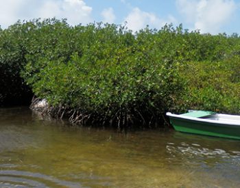
Mangroves are nature’s way of building land mass. On Bonaire, the mangrove area at Lac, for generations, has been the island incubator for the various species of fish that thrive in Bonaire’s water. The remnants of the old trees can still be seen. The fisherman recognized the importance of mangroves to the eco-system. They used to ply the canopied waterways in their boats, fishing and harvesting mangrove twigs. They used the long, pliable sticks to make mats, window coverings and other useful items. This was done by slicing the twigs into long pieces and weaving them into the desired items. Now that the mangroves are protected and the old fishermen have passed on, this art has been lost. Today the mangroves are used as a recreation area.
Mangroves are nature’s way of building land mass. On Bonaire, the mangrove area at Lac, for generations, has been the island incubator for the various species of fish that thrive in Bonaire’s water. The remnants of the old trees can still be seen. The fisherman recognized the importance of mangroves to the eco-system. They used to ply the canopied waterways in their boats, fishing and harvesting mangrove twigs. They used the long, pliable sticks to make mats, window coverings and other useful items. This was done by slicing the twigs into long pieces and weaving them into the desired items. Now that the mangroves are protected and the old fishermen have passed on, this art has been lost. Today the mangroves are used as a recreation area.
Marine Park
Bonaire has a long history of marine preservation, beginning with turtle protection in 1961, prohibition of spear fishing in 1971 and protection of coral, dead or alive, in 1975. In 1978 & 1980, the park instituted a permanent mooring system, first in the world, for boats to moor instead of dropping anchors. The driving forces behind the creation of a Marine Park on Bonaire included Bonaire devotees Captain Don Stewart and Carel Steensma and The Netherlands Antilles National Parks Foundation. Carel Steensma was a personal friend of HRH Prince Bernhard of the Netherlands, Chairman of the WWF at the time. The project of the BNMP started in 1979, with funding from WWF Netherlands, the Dutch Government, the Government of the Netherlands Antilles, and the Island Government of Bonaire.
Bonaire has a long history of marine preservation, beginning with turtle protection in 1961, prohibition of spear fishing in 1971 and protection of coral, dead or alive, in 1975. In 1978 & 1980, the park instituted a permanent mooring system, first in the world, for boats to moor instead of dropping anchors. The driving forces behind the creation of a Marine Park on Bonaire included Bonaire devotees Captain Don Stewart and Carel Steensma and The Netherlands Antilles National Parks Foundation. Carel Steensma was a personal friend of HRH Prince Bernhard of the Netherlands, Chairman of the WWF at the time. The project of the BNMP started in 1979, with funding from WWF Netherlands, the Dutch Government, the Government of the Netherlands Antilles, and the Island Government of Bonaire.
Onima Inscriptions
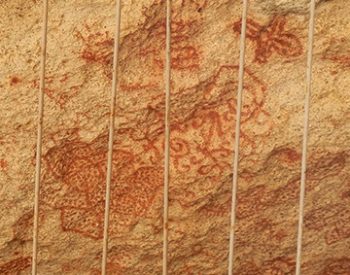
Small signposts direct the way to the Indian inscriptions found on a 3-foot limestone ledge that juts out like a partially formed cave entrance. Look up to see the red-stained designs and symbols inscribed on the limestone, said to have been the handiwork of the Arawak Indians when they inhabited the island centuries ago. The pictographs date back at least to the 15th century.
Small signposts direct the way to the Indian inscriptions found on a 3-foot limestone ledge that juts out like a partially formed cave entrance. Look up to see the red-stained designs and symbols inscribed on the limestone, said to have been the handiwork of the Arawak Indians when they inhabited the island centuries ago. The pictographs date back at least to the 15th century.
Pekelmeer Sanctuary
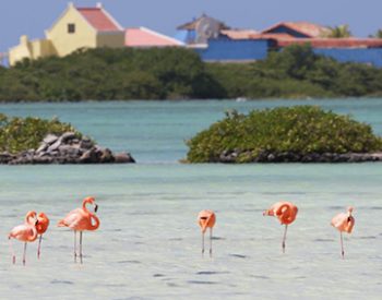
The Pekelmeer Flamingo Sanctuary is one of only four areas in the world where Flamingos breed. Pekelmeer means “salt lake” in Dutch. Pools appear pink against the white salt flats because an abundance of tiny rosy brine shrimp live in the water. The Sanctuary is located on the vast salt pans at the southern end of the island and home to over ten thousand flamingos. Tourists are not allowed in the sanctuary, but the birds can be watched with binoculars from the road or nearby Pink Beach. The Caribbean flamingo is the most colorful of all species of flamingos, due mainly to the red carotenes in their diet. The refuge also attracts dozens of other species, including osprey, cormorants, heron, frigate birds, and other marine birds.
The Pekelmeer Flamingo Sanctuary is one of only four areas in the world where Flamingos breed. Pekelmeer means “salt lake” in Dutch. Pools appear pink against the white salt flats because an abundance of tiny rosy brine shrimp live in the water. The Sanctuary is located on the vast salt pans at the southern end of the island and home to over ten thousand flamingos. Tourists are not allowed in the sanctuary, but the birds can be watched with binoculars from the road or nearby Pink Beach. The Caribbean flamingo is the most colorful of all species of flamingos, due mainly to the red carotenes in their diet. The refuge also attracts dozens of other species, including osprey, cormorants, heron, frigate birds, and other marine birds.
Rooi Lamoenchi Kunuku
Owner Ellen Cochrane-Herrera restored her family’s homestead north of Lac Bay, in the Bonairean kadushi (cactus) wilderness, to educate tourists and residents about the history and tradition of authentic kunuku living and show unspoiled terrain in two daily tours. You must make an appointment in advance: +599 717 84 89 or +599 9 540 98 00.
- For Reservations:(+599) 717-8489 or (+599) 9-540-9800
Owner Ellen Cochrane-Herrera restored her family’s homestead north of Lac Bay, in the Bonairean kadushi (cactus) wilderness, to educate tourists and residents about the history and tradition of authentic kunuku living and show unspoiled terrain in two daily tours. You must make an appointment in advance:(+599) 717-8489 or (+599) 9-540-9800
Salt Pans
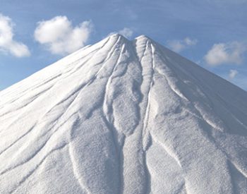
Historically, salt as a commodity was the root of war and struggles amid European factions. The eventual Dutch takeover of Bonaire, close to four centuries ago, served to underscore salt’s value. Salt production slowed with slavery abolition in 1863. It continued to be harvested fluctuating with market demand, tariffs and weather. In the 1960’s, a US company designed new solar salt works, revitalizing the industry. Today, Cargill Corporation is responsible for salt production and Bonaire’s thriving salt industry. Huge mounds of crystals can be seen on Bonaire’s south end. Nestled within Salt Company land is the Flamingo Reserve. Flamingos, protected by law, can be seen from the road. Entrance to the Reserve is prohibited to ensure their protection.
Historically, salt as a commodity was the root of war and struggles amid European factions. The eventual Dutch takeover of Bonaire, close to four centuries ago, served to underscore salt’s value. Salt production slowed with slavery abolition in 1863. It continued to be harvested fluctuating with market demand, tariffs and weather. In the 1960’s, a US company designed new solar salt works, revitalizing the industry. Today, Cargill Corporation is responsible for salt production and Bonaire’s thriving salt industry. Huge mounds of crystals can be seen on Bonaire’s south end. Nestled within Salt Company land is the Flamingo Reserve. Flamingos, protected by law, can be seen from the road. Entrance to the Reserve is prohibited to ensure their protection.
Seru Largu
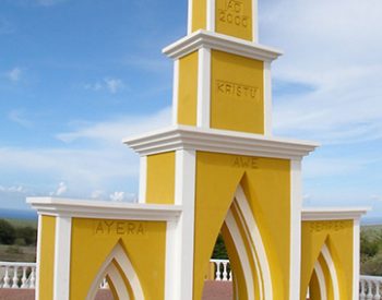
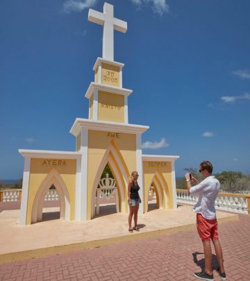
Take a drive to Seru Largu and witness the beauty of Bonaire from this lovely lookout point. Seru Largu means “large hill” and from the top, you can see the capital city of Kralendijk and the little island of Klein Bonaire. There is a monument at the site which reads in the Papiamentu language as “Kristu Ayera Awe Semper” which means “Christ, Yesterday, Today and Forever”. Seru Largu is centrally located on the island and is worth a visit if you wish to experience the beauty of Bonaire from a breathtaking elevation. This is the place to be on New Year’s Eve. The entire area is filled with people who come to watch fireworks and celebrate from this vantage point.
Take a drive to Seru Largu and witness the beauty of Bonaire from this lovely lookout point. Seru Largu means “large hill” and from the top, you can see the capital city of Kralendijk and the little island of Klein Bonaire. There is a monument at the site which reads in the Papiamentu language as “Kristu Ayera Awe Semper” which means “Christ, Yesterday, Today and Forever”. Seru Largu is centrally located on the island and is worth a visit if you wish to experience the beauty of Bonaire from a breathtaking elevation. This is the place to be on New Year’s Eve. The entire area is filled with people who come to watch fireworks and celebrate from this vantage point.
Slave Huts & Obelisks
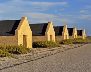
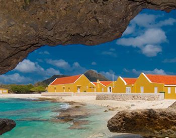
These huts were constructed in 1850 during the slavery time, and served as camping facilities for slaves working in the salt ponds to collect and ship the salt, one of Bonaire’s most important export product. These huts were used as sleeping quarters and place to put away personal belongings of the working team. Each Friday afternoon the slaves walked seven hours to Rincon to weekend with their families, returning each Sunday. Four Obelisks on Bonaire were used as navigational shore markers to guide ships coming in to load. The obelisks were painted red, white, blue and orange (the colours of the Dutch flag).
These huts were constructed in 1850 during the slavery time, and served as camping facilities for slaves working in the salt ponds to collect and ship the salt, one of Bonaire’s most important export product. These huts were used as sleeping quarters and place to put away personal belongings of the working team. Each Friday afternoon the slaves walked seven hours to Rincon to weekend with their families, returning each Sunday. Four Obelisks on Bonaire were used as navigational shore markers to guide ships coming in to load. The obelisks were painted red, white, blue and orange (the colours of the Dutch flag).
Tanki Maraka Heritage
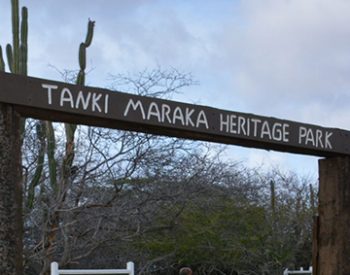
Tanki Maraka Heritage Park is a World War II open air museum highlighting the area of a U.S. military camp from 1942 to 1947. It is a self-guided tour through the premises of the old base. The park can be found along the road to Rincon. After leaving Kralendijk, be watchful for a sign to the park on the right, and then the driveway to the entrance is just a short distance.
Tanki Maraka Heritage Park is a World War II open air museum highlighting the area of a U.S. military camp from 1942 to 1947. It is a self-guided tour through the premises of the old base. The park can be found along the road to Rincon. After leaving Kralendijk, be watchful for a sign to the park on the right, and then the driveway to the entrance is just a short distance.
Terramar Museum
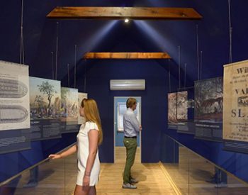
In the center of Kralendijk awaits a new adventure. One of the few remaining historic buildings in the center of town has recently been completely renovated and transformed into the new Terramar historical and archaeological museum. Let Terramar Museum take you on a journey through time and experience history like you never have before! Inside you will find a spectacular exhibition guiding you through 7,000 years of Caribbean and Bonairean history. Enter a world of fascinating artifacts, listen to long forgotten tales, and discover the past from a different perspective.
In the center of Kralendijk awaits a new adventure. One of the few remaining historic buildings in the center of town has recently been completely renovated and transformed into the new Terramar historical and archaeological museum. Let Terramar Museum take you on a journey through time and experience history like you never have before! Inside you will find a spectacular exhibition guiding you through 7,000 years of Caribbean and Bonairean history. Enter a world of fascinating artifacts, listen to long forgotten tales, and discover the past from a different perspective.
The Cadushy Distillery
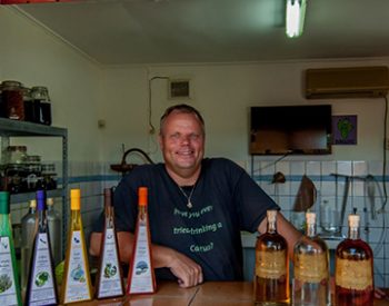
In our traditional distillery of Cadushy you can see how the world’s only liqueur made from cactus is created right on the premises, and of course, we invite you to sample some for yourself! Come and relax in our tranquil, shaded garden under our ancient Calbas trees to enjoy a variety of home-distilled liqueurs including our famous Cadushy of Bonaire Liqueur. Open every Monday, Wednesday & Friday from 10am till 5pm. No entrance fee. Just bring your good mood!
- Office Hours: Monday, Wednesday & Friday
- Tour Starts: 10:00 a.m. – 5:00 p.m.
- Price: Free!
In our traditional distillery of Cadushy you can see how the world’s only liqueur made from cactus is created right on the premises, and of course, we invite you to sample some for yourself! Come and relax in our tranquil, shaded garden under our ancient Calbas trees to enjoy a variety of home-distilled liqueurs including our famous Cadushy of Bonaire Liqueur. Open every Monday, Wednesday & Friday from 10am till 5pm. No entrance fee. Just bring your good mood! Best of all it’s free!
Washington Slagbaai
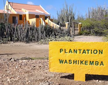
The Washington Slagbaai National Park is located in the northern end of Bonaire. It comprises of two former land plantations, Washington & Slagbaai, totaling just under 14,000 acres. These two plantations once supplied salt, charcoal, aloe extract, divi-divi pods, and goats for export to Curaçao and Europe. The Washington Plantation was secured in 1969, upon the death of the owner “Boy” Herrera. He negotiated with the government to take over the plantation upon his death with the condition that it was to remain undeveloped for the enjoyment of the people. The WNP was founded (May 9, 1969), the first Nature Sanctuary of the Netherlands Antilles. In 1979, the Slagbaai land plantation was negotiated and added to create the WSNP. The park is managed by STINAPA Bonaire.
The Washington Slagbaai National Park is located in the northern end of Bonaire. It comprises of two former land plantations, Washington & Slagbaai, totaling just under 14,000 acres. These two plantations once supplied salt, charcoal, aloe extract, divi-divi pods, and goats for export to Curaçao and Europe. The Washington Plantation was secured in 1969, upon the death of the owner “Boy” Herrera. He negotiated with the government to take over the plantation upon his death with the condition that it was to remain undeveloped for the enjoyment of the people. The WNP was founded (May 9, 1969), the first Nature Sanctuary of the Netherlands Antilles. In 1979, the Slagbaai land plantation was negotiated and added to create the WSNP. The park is managed by STINAPA Bonaire.
WillemstorenLighthouse
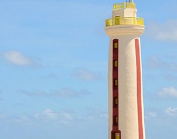
Bonaire’s first lighthouse was built in 1837. Locals stop here to collect pieces of driftwood in spectacular shapes and to build fanciful pyramids from objects that have washed ashore.
Bonaire’s first lighthouse was built in 1837. Locals stop here to collect pieces of driftwood in spectacular shapes and to build fanciful pyramids from objects that have washed ashore.

